
02.01.2024
Extended High Resolution: A clearer picture of the underground
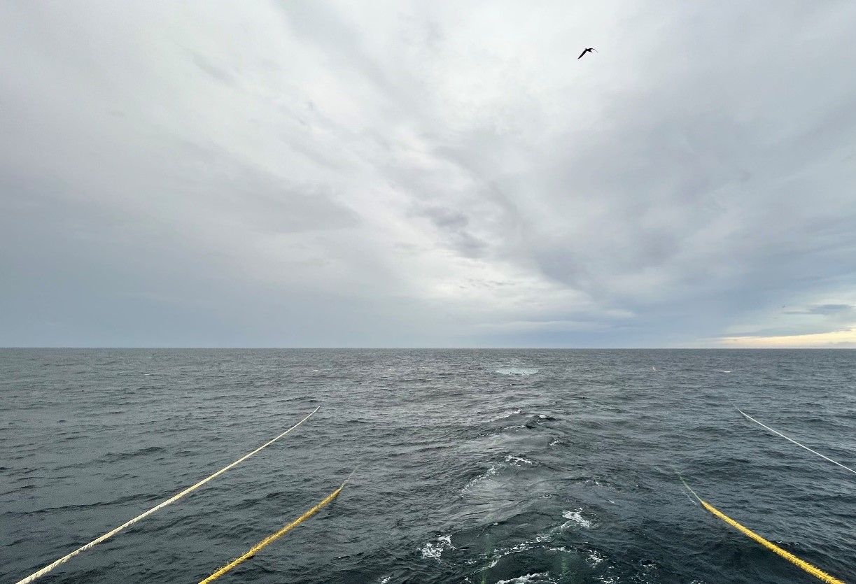
The XHR technology makes it easier to acquire high-quality seismic data. At the same time, operational footprint is reduced.
The project is supported with NOK 9.7 million by CLIMIT.
Core to CLIMIT’s main goal
It is the Norwegian seismic company TGS that has developed the Extended High-Resolution technology (XHR), for seismic mapping and monitoring of CO2 reservoirs. This allows detailed imaging of the rocks above the reservoirs (the overburden), in both 3D and 4D format. The technology also enables monitoring of how CO2 moves in the reservoir. – Here we have a project which is core to CLIMIT’s main goal; to help develop technology and reduce costs for users, says Kari-Lise Rørvik, head of CLIMIT.
Success criteria
The driving force behind the XHR project lies in renewing seismic technology – and expertise by offering cost-effective imaging solutions – to the growing CCS industry in Norway, and globally.
Extended High Resolution will contribute to the easier acquisition of high-quality seismic data from CO2 reservoirs. Key expectations for the Technology:
- Improve image quality in overlying rocks that confirm the suitability of the deposit.
- Improve reservoir-level imaging to accurately monitor CO2
- Provide a cost-effective seismic method for CO2
Reduce environmental impact e.g., by improving the utilization of vessels and local equipment.
Testing with Equinor
With a key role in the development of CCS in Norway and Europe, Equinor has shown interest in using the XHR technology. This led to collaboration between TGS and Equinor in 2020 and 2021, where the parties carried out small-scale concept testing of XHR. Promising results led to a full-scale trial of XHR at Sleipner’s CO2 storage in the North Sea, summer of 2022. This was the first time a full-scale XHR collection was demonstrated. Results show that 3D-XHR provides good quality data suitable for CCS monitoring down to a minimum depth of 1,000 metres, which is where the storage reservoir is located at Sleipner. In addition, XHR can be used for monitoring in the event of suspected leakage from deeper storage locations.
Broad exchange of experience
Operational support for the test was led from Magsei’s (now TGS) operational base in Tananger.
The company’s Oslo office was responsible for technical support. Data processing was carried out at Equinor in Stavanger. Overall, strong specialist resources in geophysics and geology contributed, both from TGS and from Equinor’s research and technology group.
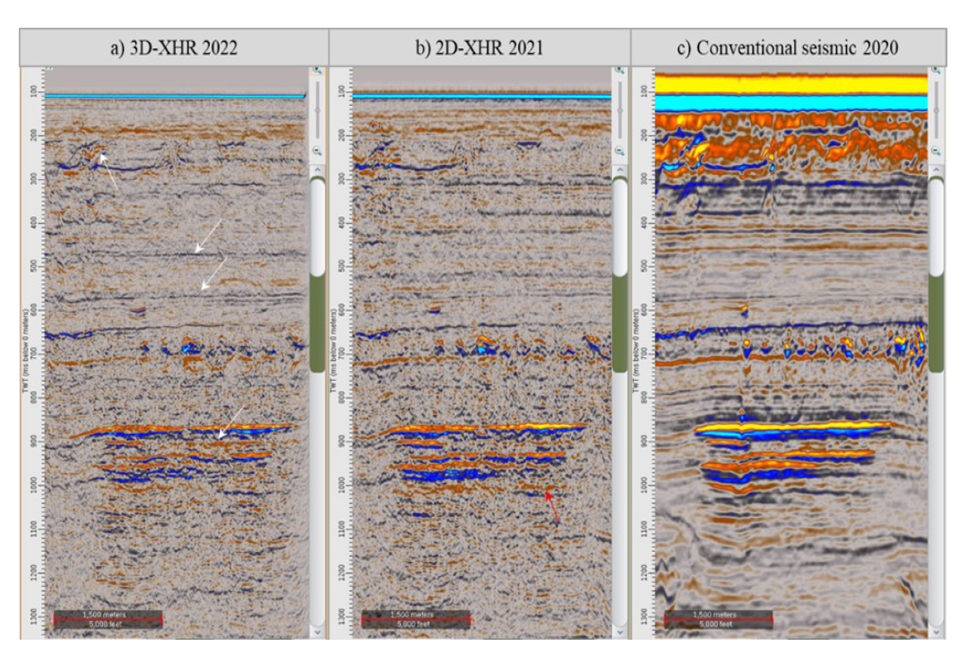
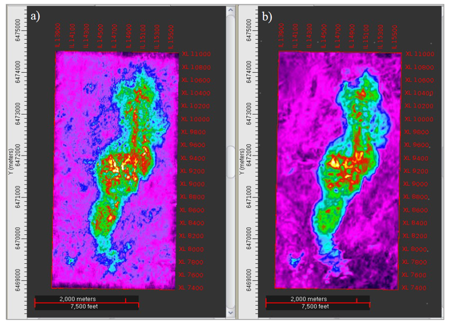
Important results from the project
The results from TGS show that 3D XHR provides very good imaging with high resolution, and thus enhanced data quality, compared to more conventional methods – both above and in the reservoir. Tests have also shown that the full-scale XHR can operate with little downtime and is more robust to weather conditions compared to similar systems.

The way forward
Overall, results shows that XHR is a flexible and effective monitoring technology for upcoming CCS projects. – The support from CLIMIT was decisive for us to be able to carry out the XHR demonstration offshore. We now have a rich data set and a combination of XHR and node data which can be used in the further work to demonstrate and implement the technology for the industry nationally and globally, says Tone Holm-Trudeng, Director Offshore Subsurface Solutions at TGS.